3D Workspace
Home
Assets
Affiliate Program
Sign up/Log in
?
Upgrade
DCC Bridge
Anonymous1774376158
03-24 18:35
Model Name
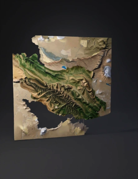
iran topographic map 3d model
Tags
nature & environment
rendering
realistic
Prompt
Accurate real-world 3D topographic terrain map of entire Iran strictly based on SRTM 30m and ASTER GDEM satellite elevation data. Perfect country shape and geological accuracy: long parallel folded thrust ridges of Zagros Mountains with deep SW-NE gorges and valleys, sharp high Alborz Mountains including prominent Damavand volcano at 5610m, perfectly flat Khuzestan alluvial plain with correct low elevation and Karun river delta, vast central Iranian plateau with salt deserts Dasht-e Kavir and Dasht-e Lut, precise Persian Gulf coastline, Strait of Hormuz and strategic Kharg Island. Realistic Landsat satellite texturing with natural hypsometric coloring: green lowlands, yellow-brown mid elevations, grey-white high peaks above 4000m. 1.65x vertical exaggeration for clear strategic visibility. Thin white international borders. Small glowing red dots for major strategic cities: Tehran, Ahvaz, Khorramshahr, Abadan, Bandar Abbas, Tab
Detailed Info
Related Models
Enter invite code
Enter invite code to get credits!