3D Workspace
Home
Assets
Affiliate Program
Sign up/Log in
?
Upgrade
DCC Bridge
Anonymous1772195903
02-27 12:43
Model Name
historical map 3d model
Tags
europe
historical
props
props historical
props rendering
props rendering historical
rendering
rendering historical
Prompt
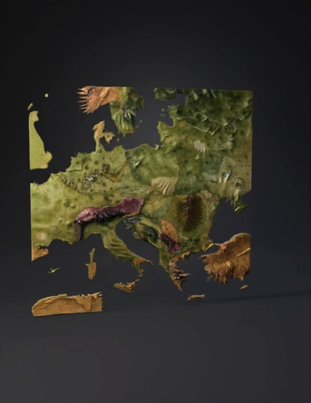
Create a highly detailed 3D historical political map of Europe as of March 3, 1878, representing the borders established by the Treaty of San Stefano. The map must be historically accurate and reflect the geopolitical situation immediately following the treaty. Render the map as a realistic 3D terrain model with elevated topography. Mountains, river systems, coastlines, and plains must be clearly defined and geographically accurate. Use physically based rendering (PBR), realistic terrain textures, and natural color grading. Political entities to depict with correct 1878 borders: Principality of Bulgaria (San Stefano Bulgaria) – including Moesia, most of Thrace (excluding Adrianople/Edirne), and Macedonia, with access to the Aegean Sea. Ottoman Empire – remaining European territories after the treaty. Kingdom of Romania. Kingdom of Serbia (with territorial expansions recognized in 1878). Principality of Montenegro (expanded territory with access to the Adriatic Sea). Russian Empire (including Bessarabia). Austria-Hungary. Kingdom of Greece. British Empire (Cyprus may be included if within map frame). German Empire. Kingdom of Italy. French Third Republic. Swiss Confederation. Visual and technical specifications: Photorealistic 3D render. Isometric perspective at approximately 45-degree camera angle. Cinematic soft shadows. Late afternoon natural sunlight with warm directional lighting. Strong relief emphasis on the Balkan Mountains, Carpathians, Dinaric Alps, and Rhodope Mountains. Clearly visible Danube River, Aegean coastline, Adriatic Sea, and Black Sea. Political borders subtly elevated or engraved into the terrain. Each state labeled with elegant 19th-century serif typography. Distinct but muted historical color palette per country (no modern bright tones). No modern borders, no modern country names beyond 1878 historical context. Clean background, neutral ocean shading, slight atmospheric haze. Ultra-high resolution, 8K quality, sharp focus, museum-grade historical atlas style.
Detailed Info
Related Models
Enter invite code
Enter invite code to get credits!